Photo of Sharon Lake, Tuolumne County, CA


Sharon Lake Fishing

Tuolumne County


Sharon Lake Fishing

Emigrant Wilderness - Tuolumne County

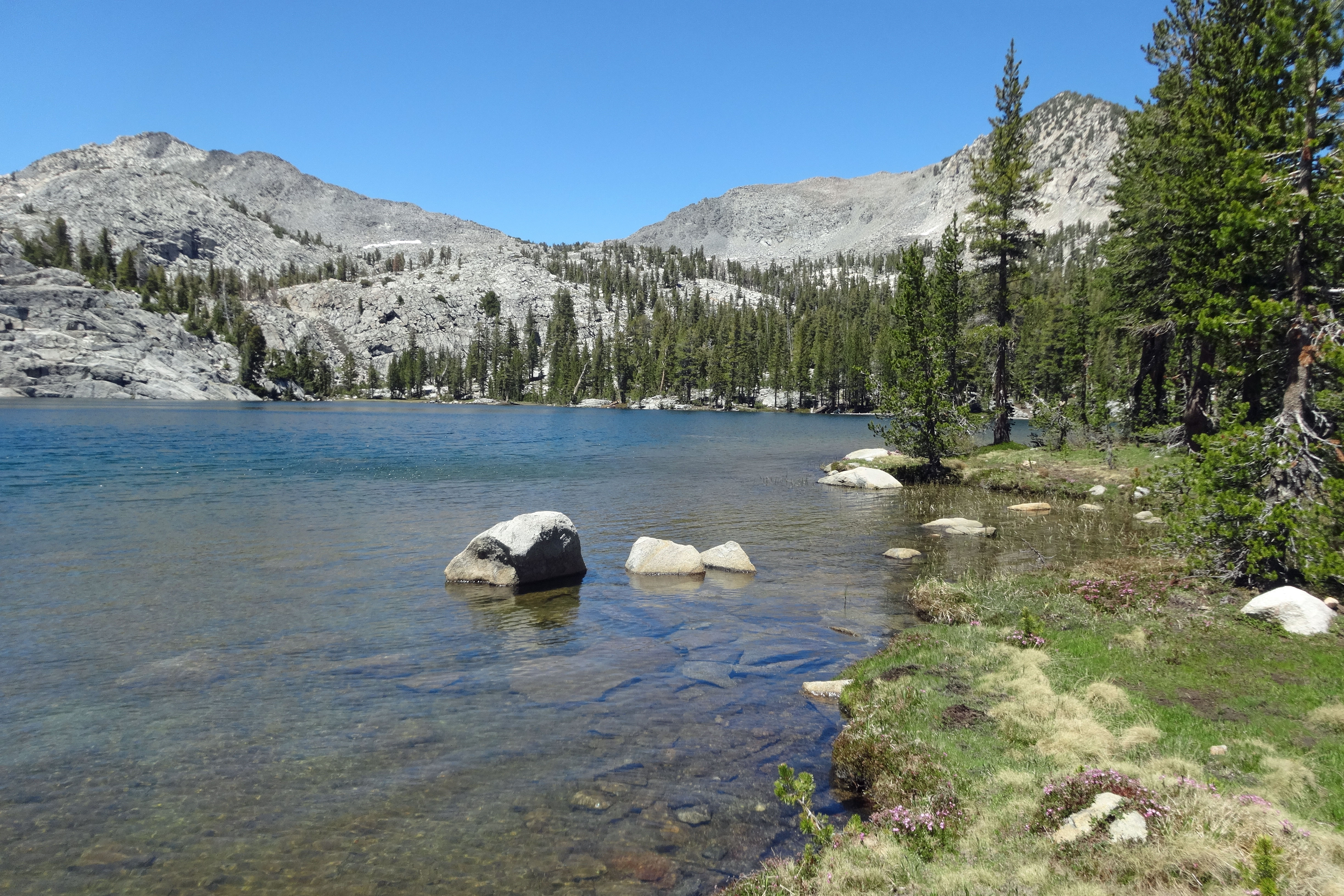
Beautiful little Sharon Lake, tucked high on a mountain side above the Kennedy Creek canyon, offers spectacular views the surrounding country and quiet fishing far away from the crowds; but getting there requires a strenuous uphill climb. The trip to Sharon Lake is best combined with other destinations within the Emigrant Wilderness.

Sidetrips

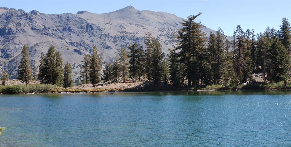
From the Sharon Lake turnoff on the trail to Kennedy Lake it's only a few more miles up to Kennedy Lake with good fishing in the creek all the way. If you backtrack to Relief Creek you can head up the trail another mile and find yourself at Relief Reservoir.

Sharon Lake, Emigrant Wilderness, Tuolumne County, California

Sharon Lake

Other Nearby Featured Trips in
Tuolumne County:


Sharon Lake turnoff, Emigrant Wilderness, Tuolumne County, California

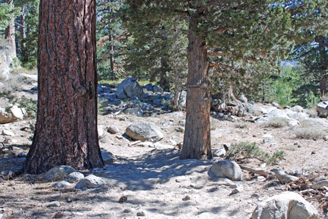
Sharon Lake Trail Turnoff


In My Creel

  • Daredevle Skeeter
  • 1/16 oz Panther Martin
  • Acme Kastmaster
  • #16 Blue Wing Olive Light Hendrickson Parachute
  • #14 light Cahill
  • #14 olive Fluttering Caddis

For fishing at Sharon Lake I brought along a few of my usual lures and flies. Arriving a little late in the morning, I soon discovered that the trout had no interest in my lures, so I switched over to fly casting and did better.


Recommended Books, Lures, and Flies for Fishing the Emigrant Wilderness


Hillside climb to Sharon Lake, Emigrant Wilderness, Tuolumne County, California

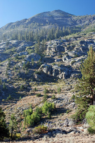
Mountainside Climb to Sharon Lake


Making Your Way to Sharon Lake

The trailhead to Sharon Lake is at Kennedy Meadows, located along Highway 108 at the foot of Sonora Pass. The wonderful old 1917 resort burned down in October 2007, two weeks after this photo was taken. A new lodge has since been completed. Kennedy Meadows is a very popular fishing destination.

The 5-mile hike to Sharon Lake takes about 3 hours, climbing nearly 3000 feet. It can be done as a day hike; but it's better to backpack, especially if you can spend several days there enjoying the solitude. (An alternative is to backpack to a campsite on Kennedy Creek, perhaps fishing at Kennedy Lake farther up the trail, and make Sharon Lake a side trip. If you do that, you can approach Sharon Lake cross-country from near Kennedy Lake, traversing along the mountainside.)

After leaving Kennedy Meadows on your way to some great fishing at Sharon Lake the trail leads up an early 20th century road used during the construction of Relief Dam. A little less than an hour of hiking will bring you to the marked trail junction to Kennedy Lake. Head uphill for Kennedy Lake.

After crossing a bridge go about one-third of a mile farther and watch carefully for horse trail leading off to the right. This is the beginning of the un-maintained trail to Sharon Lake. The junction is not marked and may well be blocked off with small logs. Watch for the two trees shown in the photo shown here. Follow the trail down to Kennedy Creek, a difficult crossing with high water. There are some logs just downstream from the horse crossing.

Once you have crossed the creek, your climb to Sharon Lake really begins. Although it is not an official Forest Service trail, it gets regular enough use from the Kennedy Meadows Pack Station that it is easy to follow. From the Kennedy Creek crossing to the lake is a stiff 1000 foot climb. (see photo)

As you stop to rest on the way up, you can look across the canyon at Nightcap Peak and back down the canyon toward your starting place, Kennedy Meadows. Kennedy Lake is out of sight up the canyon to your right. The horse trail zig-zags up the mountainside and then begins a long traverse, always angling upward. Eventually it brings you to Sharon Lake, tucked against the mountain side, 8692 feet above sea level.

Lodging and Camping

After trekking all the way to Sharon Lake and back, you'll want a soft bed. Lodging is available at Kennedy Meadows Resort. Accommodations may also be available at nearby Dardanelles Resort if they have finished rebuilding from the fire. You can also head back in Strawberry or Pinecrest. Forest Service campgrounds can be found all along the Stanislaus River and up the Clarks Fork. Among my favorites are Boulder Flat, Eureka Valley, and Baker. You can also drive up the pass and camp for free at undeveloped places such as Chipmunk Flat. While you're up there, try fishing in Deadman Creek.

California's Best Camping

For complete information about more campgrounds along Highway 108, see

California's Best Camping website logo

High Sierra Trails

Buck Lakes, Emigrant Wilderness, California

Buck Lakes, Emigrant Wilderness

High Sierra Trails website logo


Fishing Supplies

On your way to Sharon Lake you can pick up fishing supplies at the following places:

  • Bass Pro Shop, Manteca.
  • Oakdale Bait and Tackle, Oakdale, on Highway 108/120.
  • Mother Lode Fly Shop, Sonora
  • Big 5 Sporting Goods, Sonora
  • Pinecrest Sports Shop, Pinecrest
  • Dardanelles Resort (hopefully soon)
  • Kennedy Meadows Resort
  • Ken's Sporting Goods, Bridgeport