Fishing Fordyce Creek
Nevada County
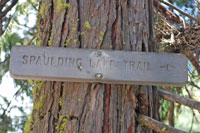
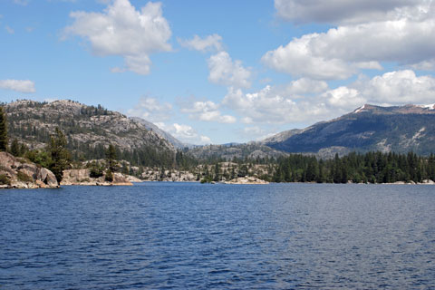
Fordyce Creek runs from Fordyce Lake to Lake Spaulding in Nevada County. It lies only a few miles north of Interstate 80 near Cisco Grove in California's northern Sierra Nevada.
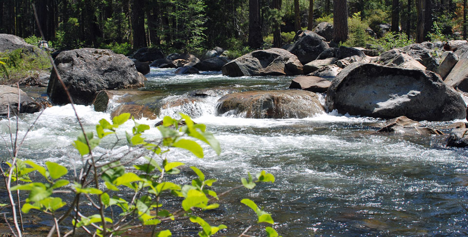
Fordyce Creek offers good fishing for rainbow and brook trout along its 9-mile length. An Off Highway Vehicle (OHV) route, which attracts a lot of 4-wheeler enthusiasts, runs from Indian Springs to Fordyce Lake. A spur trail from the OHV route cuts over to the Eagle Lake area and then connects to Fordyce Creek, making an easy 3-mile hike.
I chose instead to approach from the lower end of Fordyce Creek by way of Lake Spaulding on a less well-known trail, thus avoiding the 4-wheeler traffic. It's only a 2½-mile hike. The trail starts at an elevation of 5,500' and drops a couple hundred feet to Lake Spaulding, making it a good early season outing.
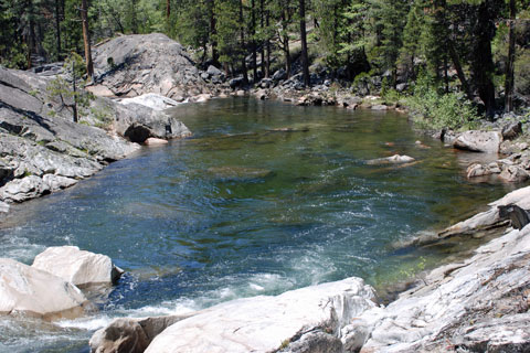
Spaulding Lake
Sidetrips
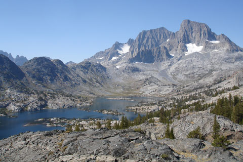
If you have someone to pick you up, you could make a one-way trip, either by starting at Eagle Lakes and exiting at Spaulding Lake or the other way around. It's about a 7½-mile hike with only a few hundred feet of elevation changes.
Nearby Featured Trips in Nevada County
- Crooked Lake - a wonderful place for carefree fishing
- Glacier Lake - a beautiful setting with golden trout in the lake
- Lower Lola Montez Lake - easy hike from I80 near Donner summit
- Milk Lake - great fly fishing close to the trailhead at Grouse Lookout
- Penner Lake - one of the best fishing lakes in Grouse Ridge
- Round Lake - a quiet, little lake in Grouse Ridge
Fordyce Creek
In My Creel
- Gold Ribbed Hare's Ear
- Woolly Bugger
- #16 Olive Bead Head Bird's Nest
- #8 Zug Bug
- #16 Soft Hackle
- Panther Martin
At Fordyce Creek, I used a lot of wet flies, but I also tried some casts with my spin casting outfit (with no luck).
Shop Amazon for
Trout Fishing Best Sellers
Trout Fishing Best Sellers
Recommended Books, Lures, and Flies for Fishing Fordyce Creek
- Top Trails: Sacramento: Must-do Hikes for Everyone, Steve Evans. Covers hikes from California's Sacramento Valley to the Sierra, including a section on Grouse Ridge.
- Fly Fishing Trout Flies | Essential Flies for Trout | Hand-Tied Dry Flies, Nymphs, Streamers 32 of the most proven Trout flies, well-known for their timeless fish-catching effectiveness.
- Mepps Plain Lure Assortment Trouter Kit Spinner blades are silver or gold plated, copper, or polished brass .
- California's Best Fly Fishing: Premier Streams and Rivers from Northern California to the Eastern Sierra, Chip O'Brien. An up-to-date guidebook, complete with maps, detailed descriptions of fishing locations, analysis of the seasonal differences which affect fishing, and fly patterns.
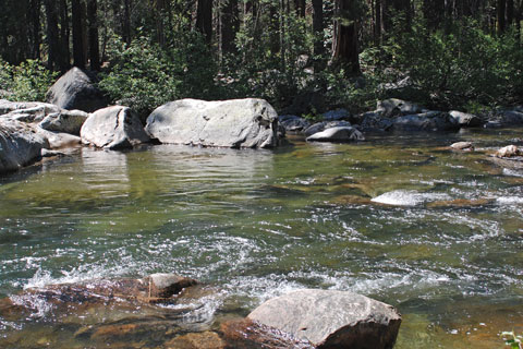
Fordyce Creek